
Master GIS: ArcGIS for Hydrology, Spatial Analysis, Remote Sensing & Cartography
20 in 1 Career Guided Programme | 200 CPD Points| Free PDF & Hard Copy Certificate| Tutor Support| Lifetime Access
Academy for Health & Fitness
Summary
- CPD Accredited Digital Certificate - Free
- CPD Accredited Hard Copy Certificate - Free
- Award in Spatial Analysis in ArcGIS at QLS Level 2 - £79
- Exam(s) / assessment(s) is included in price
- Tutor is available to students
Add to basket or enquire
Overview
***24 Hour Limited Time Flash Sale***
►►► Master GIS: ArcGIS for Hydrology, Spatial Analysis, Remote Sensing & Cartography Admission Gifts ◄◄◄
★★ FREE PDF & Hard Copy Certificate| PDF Transcripts| FREE Student ID| Assessment| Lifetime Access| Enrolment Letter★★
Have you ever dreamed of turning your love for maps and data into a fulfilling career? The geospatial science field is booming in the UK, but a recent study by the Chartered Institute of Environmental Management revealed a shocking fact: 72% of environmental consultancies are struggling to find qualified professionals with the right GIS and data analysis skills. That's where our Master GIS program comes in!
This Master GIS program provides in-depth training on ArcGIS, the industry-standard GIS software. You'll master essential skills like spatial analysis, remote sensing for data collection, and creating professional maps using both ArcGIS and open-source QGIS. Additionally, you'll gain expertise in Python programming, data visualisation, and web mapping, making you a highly sought-after geospatial professional.
With this Master GIS: ArcGIS for Hydrology, Spatial Analysis, Remote Sensing & Cartography bundle, you will get 20 CPD Accredited PDF Certificates, Hard Copy Certificates, and our exclusive student ID card, all absolutely free.
Courses Are Included In this Master GIS: ArcGIS for Hydrology, Spatial Analysis, Remote Sensing & Cartography Career Bundle:
- ➽ Course 01: Diploma in ArcGIS for Hydrology at QLS Level 4
- ➽ Course 02: Award in Spatial Analysis in ArcGIS at QLS Level 2
- ➽ Course 03: Remote Sensing in ArcGIS
- ➽ Course 04: QGIS Cartography
- ➽ Course 05: Business Intelligence and Data Mining Diploma
- ➽ Course 06: Python Data Science
- ➽ Course 07: Spatial Data Visualization and Machine Learning in Python Level 4
- ➽ Course 08: Web Scraping and Mapping Dam Levels in Python and Leaflet Level 4
- ➽ Course 09: Maps in R Shiny and Leaflet
- ➽ Course 10: Create Smart Maps in Python and Leaflet Level 3
- ➽ Course 11: Advanced Diploma in Geology
- ➽ Course 12: Structural Geology, Tectonics & Rock Mechanics
- ➽ Course 13: Geospatial Technology, Remote Sensing and Web Mapping
- ➽ Course 14: Environmental Management
- ➽ Course 15: Environmental Law
- ➽ Course 16: Carbon Literacy Project
- ➽ Course 17: Forensic Anthropology
- ➽ Course 18: Autocad Design
- ➽ Course 19: Meteorology
- ➽ Course 20: Architectural Studies
Invest in Your Future: Whether you're looking to launch a new career in GIS or enhance your existing skillset, this course bundle is your perfect starting point. Take your first step towards a rewarding career – enrol today!
Learning Outcomes of Master GIS: ArcGIS for Hydrology
- Apply advanced ArcGIS techniques for hydrological analysis.
- Conduct spatial analysis to uncover hidden patterns in geospatial data.
- Utilise remote sensing imagery to extract valuable information.
- Create professional and informative maps using ArcGIS and QGIS.
- Analyse and visualise spatial data using Python libraries.
- Develop interactive web maps using Python and Leaflet.
Why Choose Us?
- Get a Free CPD Accredited Certificate upon completion of Master GIS: ArcGIS for Hydrology
- Get a free student ID card with Master GIS: ArcGIS for Hydrology Training program (£10 postal charge will be applicable for international delivery)
- The Master GIS: ArcGIS for Hydrology is affordable and simple to understand
- This course is entirely online, interactive lesson with voiceover audio
- Get Lifetime access to the Master GIS: ArcGIS for Hydrology course materials
- The Master GIS: ArcGIS for Hydrology comes with 24/7 tutor support
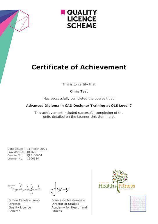
Achievement
Certificates
CPD Accredited Digital Certificate
Digital certificate - Included
Upon passing the Course, you need to order a Digital Certificate for each of the courses inside this bundle as proof of your new skills that are accredited by CPD QS for Free.
CPD Accredited Hard Copy Certificate
Hard copy certificate - Included
Please note that International students have to pay an additional £10 as a shipment fee.
Award in Spatial Analysis in ArcGIS at QLS Level 2
Hard copy certificate - £79
Please note that International students have to pay an additional £10 as a shipment fee.
CPD
Course media


Description
Take a step toward a brighter future!
*** Course Curriculum ***
➽ Course 01: Diploma in ArcGIS for Hydrology at QLS Level 4
Section 01: Introduction To ArcGIS Software
- Introduction to ArcGIS software
- Selection by Location, attributes, clip features and tables to Excel
- Performing actions on the data: change the projections, dissolve, clip
- From .TXT and .DXF to shapefile
- Calculations with attribute table and KML files in ArcMap
- Export from ArcMap to PDF
- ArcScene 3D
- GIS Example Test
- AutoCAD fixing polygon coordinates
Section 02: ArcGIS For Hydrology
- Download hydrological data
- Calculate flow direction and flow accumulation
- Watershed delineation
- Clip layers to watershed boundary
- Stream segments and catchments areas
- Stream order convert to vector
- Spatial join to catchments
- Join stream id to stream order
- Map data and initial layout
- Add and format map elements
➽ Course 02: Award in Spatial Analysis in ArcGIS at QLS Level 2
- Module 01: Point Density Analysis
- Module 02: Raster Calculator and Vector Isolation
- Module 03: Raster to Topography
- Module 04: Raster Reclassification
- Module 05: Raster Overlay
- Module 06: Slope Analysis and Hydrology tools
- Module 07: Introduction to TIFF Files
- Module 08: Introduction to 3D Surfaces
- Module 09: Satellite Images and TIN Surfaces
- Module 10: Exercise
➽ Course 03: Remote Sensing in ArcGIS
- Module 01: Remote sensing, satellite images, spectral bands introduction
- Module 02: Layers stacking satellite images
- Module 03: Georeferencing satellite images
- Module 04: Introduction to geoprocessing raster tools
- Module 05: Raster Analysis Functions
- Module 06: Georeferencing toposheet
- Module 07: Site suitability using weighted overlay analysis – part 1
- Module 08 Site suitability using weighted overlay analysis – part 2
- Module 09: Watershed Delineation from DEM
- Module 10: Unsupervised classification
=========>>>>> And 17 More Courses <<<<<=========
How will I get my Certificate?
After successfully completing the course, you will be able to order your Certificates as proof of your achievement.
- PDF Certificate: Free (Previously it was £12.99*20 = £259)
- CPD Hard Copy Certificate: Free ( For The First Course: Previously it was £29.99)
- QLS Endorsed Hard Copy Certificate: £79)
Who is this course for?
Anyone interested in learning more about the topic is advised to take this bundle. This bundle is ideal for:
- GIS enthusiasts
- Environmental scientists
- Urban planners
- Data analysts
- Geographers
Requirements
You will not need any prior background or expertise to enrol in this course.
Career path
After completing this course, you are to start your career or begin the next phase of your career.
- GIS Analyst
- Cartographer
- Environmental Consultant
- Data Scientist
- Web Developer
- Planner
Questions and answers
Currently there are no Q&As for this course. Be the first to ask a question.
Reviews
Currently there are no reviews for this course. Be the first to leave a review.

Add to basket or enquire
Course provided by
Legal information
This course is advertised on reed.co.uk by the Course Provider, whose terms and conditions apply. Purchases are made directly from the Course Provider, and as such, content and materials are supplied by the Course Provider directly. Reed is acting as agent and not reseller in relation to this course. Reed's only responsibility is to facilitate your payment for the course. It is your responsibility to review and agree to the Course Provider's terms and conditions and satisfy yourself as to the suitability of the course you intend to purchase. Reed will not have any responsibility for the content of the course and/or associated materials.